Archaeological Survey

Archaeological surveys are used to assess a site without the need for extensive excavation. They can help identify visible or buried features, provide information about the archaeological potential of an area and determine whether any further investigation may be necessary.

Geophysical Survey

Geophysical survey is a non-invasive method used to identify and map sub-surface anomalies without the need for ground disturbance. Specialist electronic survey equipment is used to detect variations within the ground which may indicate buried archaeological features such as walls, ditches, foundations or other changes below the surface.

A.P.A.C. Ltd undertakes electrical resistivity surveys in-house and can coordinate other specialist geophysical techniques through trusted partners where required. The results are interpreted alongside the known geology, landscape and archaeological background of the site to help distinguish potential archaeological features from natural variations.

Geophysical surveys are often carried out at an early stage of archaeological investigation, sometimes before or during the planning process, and can help determine whether further archaeological work may be necessary.

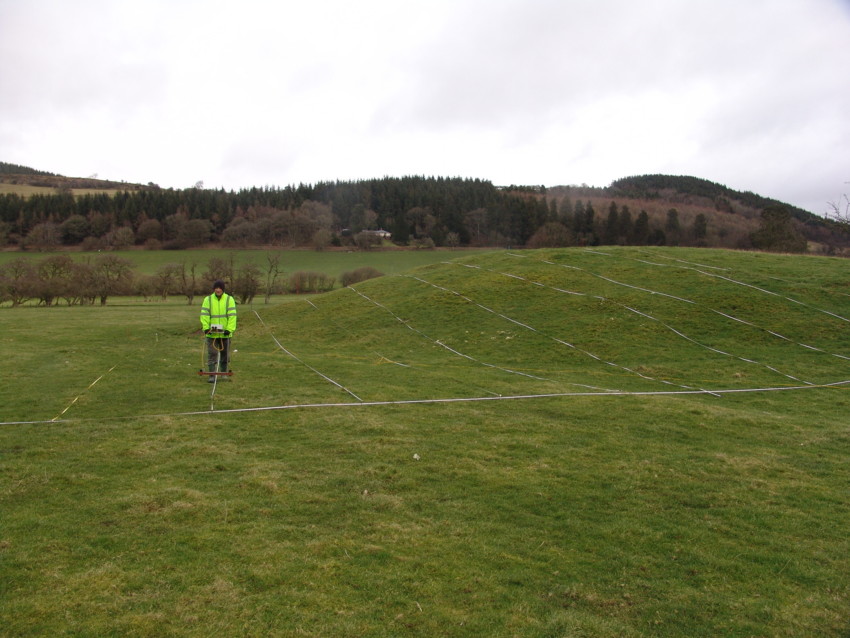
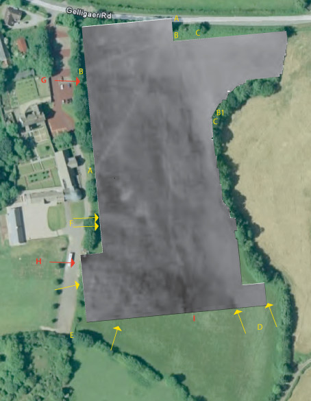
See below for an example of an electrical resistivity survey being carried out in the field, alongside the resulting survey plot showing variations recorded across the site.

Archaeological Services Wales, Archaeological Contractor Midlands, Local Archaeologist

Metal Detector Survey

A systematic archaeological metal detector survey is used to identify and record metallic artefacts within ploughsoil and other near-surface deposits. Unlike recreational metal detecting, archaeological surveys are carried out using a controlled methodology so that the location and context of finds can be accurately recorded.

The distribution of recovered material can provide valuable information about past activity and land use, even where there are few or no visible archaeological remains. When combined with mapping and other archaeological evidence, the results can help identify areas of interest and contribute to the wider interpretation of a site.

Metal detector surveys may be undertaken as a standalone investigation or as part of a wider programme of archaeological assessment and fieldwork.

Walkover Survey

A walkover survey involves the systematic inspection of a site to identify and record archaeological remains and historic landscape features visible at ground level. These may include earthworks, former boundaries, tracks, structures, building platforms or other evidence of previous activity within the landscape.

The field survey is typically supported by historic mapping, aerial photography and LiDAR data, allowing visible features to be considered alongside evidence for the historical development of the site. Photography, measured survey and terrain modelling may also be used where appropriate.

Walkover surveys provide a relatively quick and non-invasive way of assessing the character and condition of a site and can help determine whether particular areas require further archaeological investigation.